


Crêtes et lacs - Entre Schlucht et Forlet

aout60
User
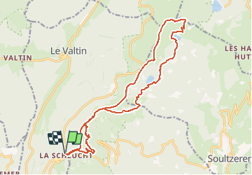

Length
20 km

Max alt
1300 m

Uphill gradient
821 m
Km-Effort
31 km

Min alt
1049 m

Downhill gradient
819 m
Boucle
Yes
Creation date :
2020-09-16 09:59:19.174
Updated on :
2020-09-16 10:49:20.073
6h24
Difficulty : Difficult

FREE GPS app for hiking
 SityTrail
IGN / Geographical institutes
SityTrail Plus
The world is yours!
About
Trail Walking of 20 km to be discovered at Grand Est, Vosges, Le Valtin. This trail is proposed by aout60.
Positioning
Country:
France
Region :
Grand Est
Department/Province :
Vosges
Municipality :
Le Valtin
Location:
Unknown
Start:(Dec)
Start:(UTM)
352667 ; 5325375 (32U) N.
Comments